Catahoula in the 19th Century

It’s one thing to investigate the history of a place when there are photographs to study and people to interview, but push back into the nineteenth century and those familiar ways of reaching into the past quickly abandon you. The memory of a place becomes reduced to whatever rare traces happened to have survived by being written down or otherwise preserved, the infinitesimal residue of what was once a fully inhabited world.
Interestingly, though, the farther away we get from nineteenth-century Catahoula, the more we seem to discover it. When I first began writing about Catahoula in the early 2010s, many of our oldest newspapers had not been digitized. Now they’re searchable online, and names and places that had disappeared into the darkness are once again within reach. Fishing excursions. Strange seismic events. Railroad maps. Scholarly botanical journals. Advertisements for lodging. The scattered fragments retrieved from the static of history converge and begin to sketch the half-forgotten contours of that small and fascinating lake.
Getting There by Water
Catahoula, in the nineteenth century, was synonymous with Catahoula Lake. In other words, there was no established community around that body of water yet. There was only a lake at the western edge of the Atchafalaya Basin—le plus joli et le plus poissonneux, in the words of one nineteenth-century journalist—the prettiest and most fish-filled of lakes.
The modern spelling of the lake’s name, Catahoula, is attested in newspaper sources from 1899 forward. Prior to that, throughout most of the nineteenth century, the name of the lake, as it appeared in English-, French-, and German-language newspapers of the day, was spelled Catahoulou.
And before the lake had a spelling, of course, it was a sound spoken by the indigenous people who lived there, a sound that became filtered through French ears and French orthography to give us Catahoulou. I have also found it written Cata-Oulou, which is my preferred rendering of the old name because it comes closest to the way my French-speaking grandparents pronounced it: KA-TA-OO-LOO.
William A. Read, the pioneering scholar of Louisiana place names, concluded that the most convincing derivation of that name amounted to “beloved lake,” which he reconstructed from Choctaw okhata, “lake,” and hullo, “beloved,” “sacred,” or more loosely, “of great worth or value.” This etymology explains why the lake in the 19th century was simply called Catahoulou and not Catahoulou Lake. The word itself already carried the lake within it. Whatever its precise linguistic history, the name itself tells us something important: amid a bewildering abundance of lakes, bayous, coulees, bays, sloughs and flooded woods, this particular lake was characterful enough to be singled out and given a name.
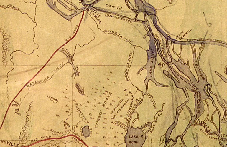
Detail from 1863 map prepared by order of Major General N.P. Banks
Three miles long by one mile wide, at its widest point, with a depth averaging eighty feet, it was an unusually deep lake for southern Louisiana, where shallow bayous and swampland were more the norm. The slender, crystalline lake with its steep banks, ensconced as it was in the deep woods and relatively isolated from the surrounding swampland, could be reached only with some effort. It was an oasis of sorts, this canyon-like pocket of clear freshwater set like a sparkling jewel into a paradise of palmettos and live oaks, with its southern end opening up into a network of forking waterways before emptying into Cocodrie’s lagoons and eventually the Atchafalaya River.
In the nineteenth century, two principal waterways fed Catahoula Lake—Catahoula Coulée from the west and Bayou Mercier from the east. The two waterways served the lake in very different ways.
Catahoula Coulée drained the prairie country between Catahoula and Bayou Teche to its west. It did not, however, provide a continuous navigable route into the great network of rivers, lakes, and bayous beyond the community. As an avenue of travel, it was essentially local.
Leaving Catahoula Lake by Bayou Mercier, however, a boat could wind eastward through the swamp to Bayou La Rose, and from there the Atchafalaya River. Catahoula Lake, then, was not a watery dead end. It was located at the westernmost edge of an enormous interconnected maze of waterways stretching across the Atchafalaya Basin and, ultimately, outward toward the Gulf.
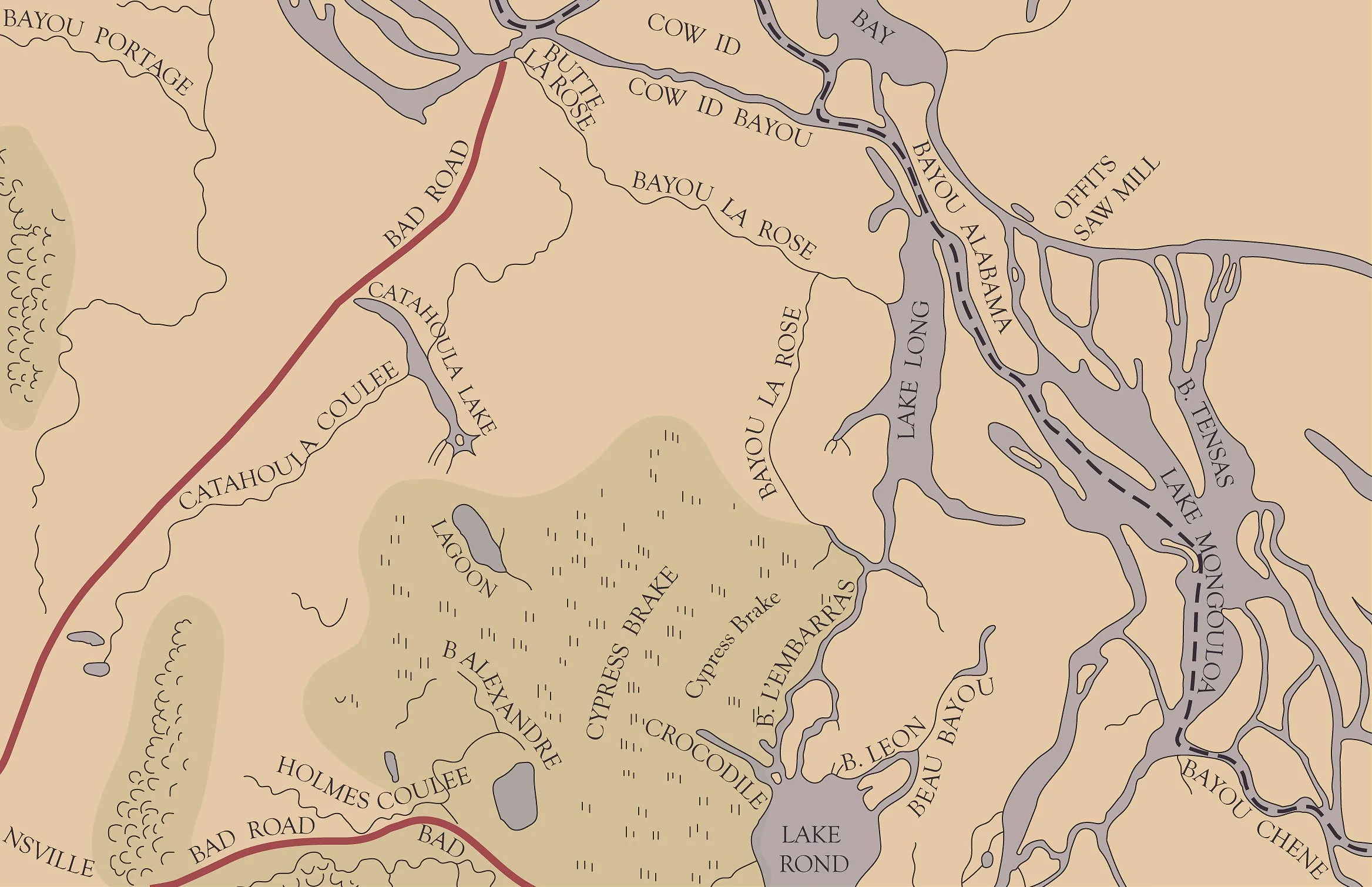
Digital recreation of detail from 1863 map prepared by order of Major General N.P. Banks
Getting There by Land
By water, Catahoula Lake had a back door into the vast aquatic world of the Atchafalaya Basin. By land, it was more remote.
On this 1863 map you can see that there is a “bad road” connecting St. Martinville with Butte La Rose. This would have been the only way to access Catahoula Lake by horse, mule, or narrow-wheeled charrette. The old road, which, according to this map, skirted the north end of Catahoula Lake, has disappeared without a trace. If you’re familiar with the road that connects St. Martinville with Catahoula through Isle Labbé today—Highway 96, also known as the Catahoula Highway—you can see how it follows a slightly different trajectory, closer to the trajectory of the coulée, to arrive at the lake’s midpoint.
The railroad finally reached St. Martinville in 1882 after nearly thirty years in the making. Its ancestor was the New Orleans, Opelousas & Great Western, an ambitious antebellum railroad that was begun in 1852, pushing westward from Algiers to Brashear City—today’s Morgan City—by 1857. Shipping magnate Charles Morgan acquired the struggling line in 1869, rebuilt it, modernized it, and folded it into the transportation empire that became Morgan’s Louisiana & Texas Railroad and Steamship Company.

Morgan’s Louisiana and Texas Railroad and Steamship Company—June 30, 1918
The old railroad was then extended westward across Acadiana. Its main line passed through Cade, on its way from New Iberia to Lafayette, and in 1882 a seven-mile-long branch was completed from Cade to St. Martinville. From there an overland journey of another seven miles into the very heart of the woods—les Grand Bois de Catahoulou—finally connected Catahoula Lake to the expanding railroad infrastructure.
Catahoulou Hotel
The opening of the Catahoulou Hotel was announced in the Attakapas Gazette on July 31, 1841. Not to be confused with the Rousseau Catahoula Inn—the state-of-the-art dance hall and restaurant that opened on Catahoula Lake in 1928—the Catahoulou Hotel was a much earlier establishment, a boarding and coffee house on the lake, the only trace of which I have found is this small newspaper advertisement.
It was forwarded to me by Ann Hall McGuffey, who has been researching the family of Hippolyte Martinet, a Belgian immigrant to Louisiana. Martinet’s wife was Marie Louise Benoit, a Creole woman of color from St. Martinville who was enslaved for a considerable portion of her life. In 1848, in an interesting wrinkle to this story, Monsieur Martinet would eventually purchase the freedom of Marie Louise, their first son, and Marie Louise’s mother. Among their children were Louis André Martinet, who would become an important figure in civil rights history, and Pierre François Hippolyte Martinet, who would sculpt the Lourdes grotto that still graces the interior of St. Martin de Tours Church in St. Martinville today.
I wish I could tell you more about the Catahoulou Hotel—what it looked like, who slept there, how the house coffee was served. Was the hotel meant primarily for hunters and fishermen? For travelers moving through the Attakapas country by water? A woodsy respite from yellow fever, which would build to epidemic status in New Orleans in August of that same year? Was it a simple lakeside house with a bed or two to spare, a pot of coffee on the ever-burning fire and a sign in French out front?
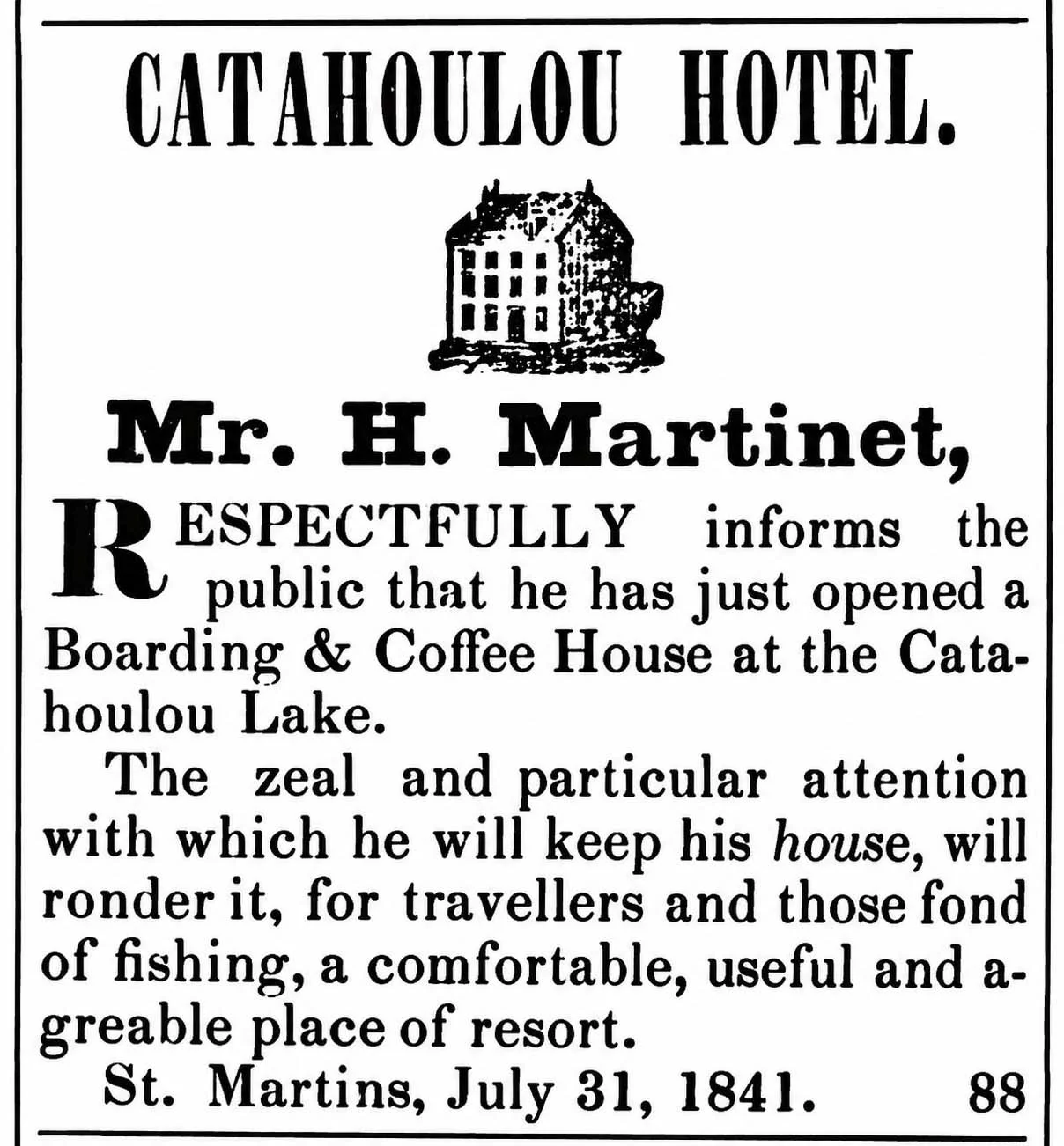
Attakapas Gazette—July 31, 1841
The little woodcut printed above the notice unfortunately offers no answers. It should not be taken as a representative portrait of the Catahoulou Hotel itself. Nineteenth-century newspapers kept drawers of stock woodcuts—steamboats, horses, houses, storefronts—which printers could pull out whenever an advertisement called for one. The tidy two-story hotel pictured in the Gazette was almost certainly just such a conventional image.
For now, all we have is its name, a date, a few lines of type, and the tantalizing knowledge that in the summer of 1841, long before there was much of a community here to speak of, Monsieur Martinet, newly arrived from Belgium, visited Catahoulou and decided there were enough people coming and going there to warrant the establishment of a hotel.
Seismic Activity
On Saturday, May 7, 1842, Catahoula Lake, without warning, rose more than six feet, according to an inhabitant of Catahoula who was fishing in the lake at the time. First reported in the St. Martinsville Creole, the story was unusual enough to be reprinted in papers across the country, including the Indianapolis Indiana Journal and The Jeffersonian Republican, a weekly paper out of Stroudsburg, Pennsylvania. I have reproduced the brief article from June 8, 1842 below in full.
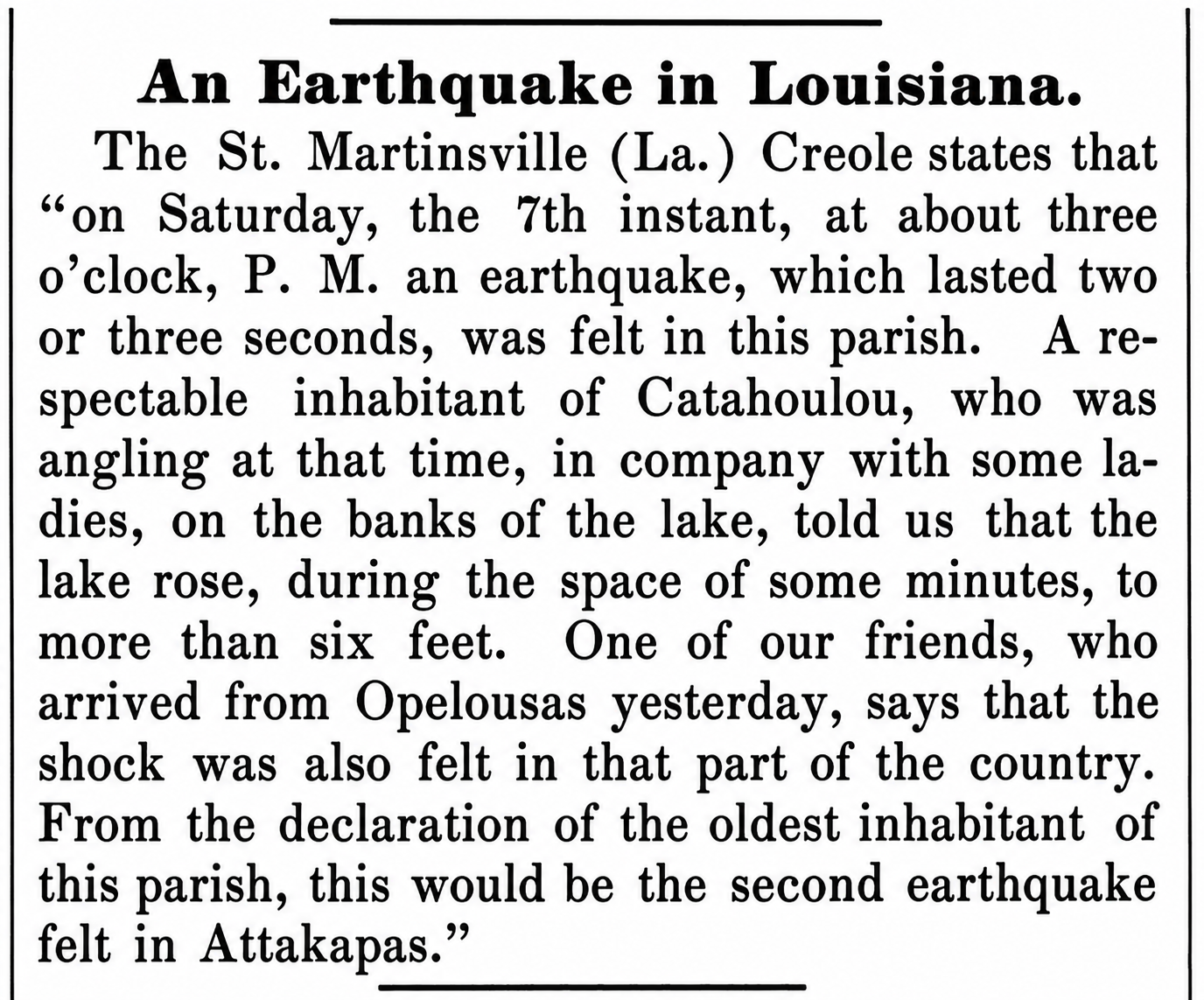
Jeffersonian Republican—June 8, 1842
It should be noted that “the 7th instant” is an outdated way of saying “the 7th of the present month,” here referring to May the 7th, even though the article did not appear until June. The event was notable enough to have been picked up by Der Vaterlandsfreund und Geist der Zeit, a German-language newspaper published in Canton, Ohio.
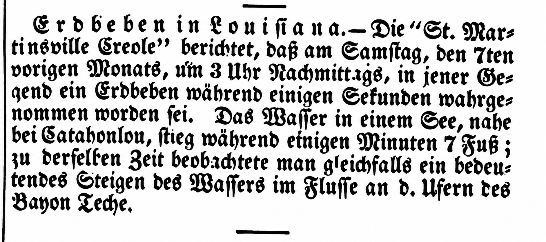
Der Vaterlandsfreund und Geist der Zeit—June 17, 1842
As it turns out, the sudden rise in the lake had occurred at the same time that an earthquake was devastating northern Haiti, almost 1500 miles away from the tiny lake in St. Martin Parish. The 1842 Cap-Haïtien earthquake had an estimated magnitude of 8.1 and triggered a destructive tsunami. The shocks annihilated the northwest Cape and killed 5,000 people (about half the population) at Cap-Haïtien alone. In less than one minute the towns of Cap-Haïtien, Santiago de los Caballeros, Port-de-Paix, Mole St. Nicolas, and Fort Liberte were reduced to heaps of ruins. The earthquake had also produced far-reaching effects, including ground oscillations in various bodies of water in Louisiana.
The reported rise of the lakewater was likely what is called a seiche, pronounced roughly saysh, which is a standing wave in an enclosed or partly enclosed body of water, such as a lake, bay, harbor, or even a swimming pool. It is essentially the whole body of water sloshing back and forth in its basin. Seiches can be triggered by earthquakes, especially powerful earthquakes that generate seismic waves that travel through the solid earth for enormous distances. When those waves reach a lake, the movement of the lake basin can set its water oscillating—even when the earthquake itself occurred hundreds or thousands of miles away.

Mecklenberg Jeffersonian—June 14, 1842
An article in the Mecklenburg Jeffersonian, a newspaper out of Charlotte, North Carolina, more explicitly connected the two events.
It is stated that the earthquake which destroyed some ten thousand lives in St. Domingo, on the 7th of May, was felt on the same day, and nearly on the same hour in Louisiana, where it caused the waters of the lake at Catahoulou to rise suddenly six feet. There was also a violent shock and much alarm on the same day at Mayaguez, Porto Rico. It is greatly feared that some of the other West India Islands have suffered seriously by a similar visitation.
And as if that 1842 event weren’t enough to brand the already queer lake with a certain seismic mystique, another strange disturbance came along in 1899 to deepen the mystery and add another story to the growing legend of Catahoulou.
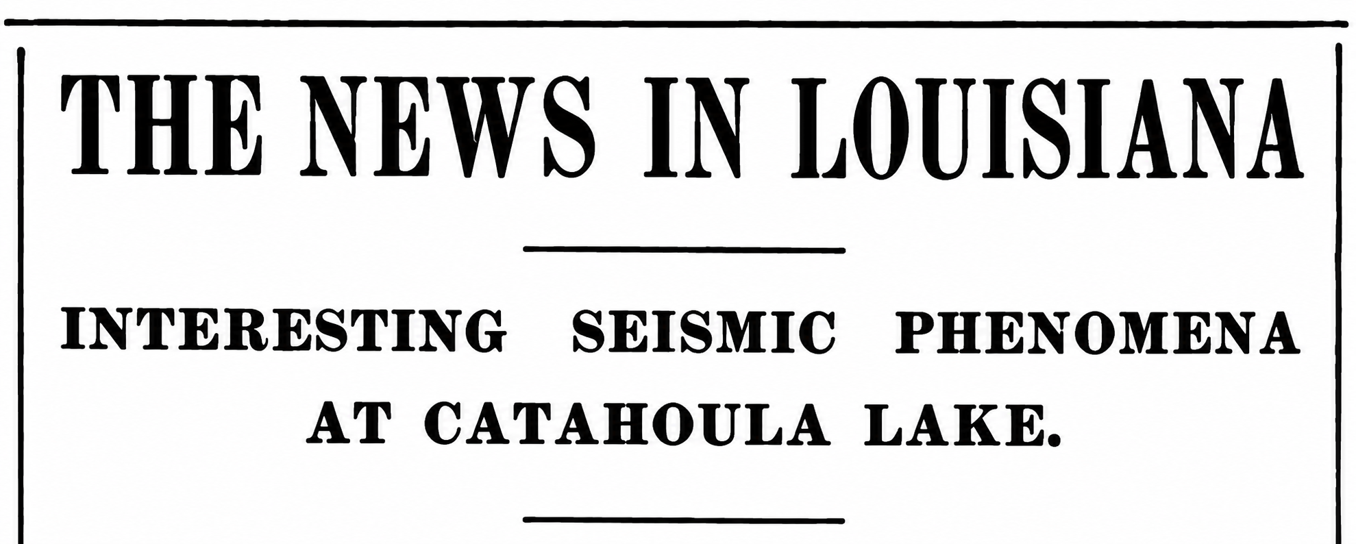
The Times-Democrat—September 16, 1899
St. Martinville, Sept. 15.—An incident took place at Catahoula Lake last Sunday which for the last five days has been the topic of conversation. No less than seventy-five persons were out fishing at Catahoula Lake Sunday.
The lake, which is not known to communicate with any other body of water, was calm and as bright as a mirror; not a breath of air moved the leaves in the trees, when all at once bubbles were seen to rise on the surface of the water, the lake appeared to rise in the centre, and for ten minutes waves swept the banks of the lake, the water rising eighteen inches at the time, after which it gradually receded to its ordinary level.
This phenomena was witnessed twice the same day. More importance is now attached to the incident, since reports from Bayou Teche, Bayou Courtableau and Bayou Teche have reached this place, stating that the same phenomena was witnessed at these places at the same hour Sunday. Most of the people here are inclined to ascribe the cause to some seismic disturbance.
Seismic essentially means relating to vibrations or elastic waves traveling through the Earth. Those waves can be generated by tectonic earthquakes, but also by other sudden movements underground—volcanic activity, landslides, mine collapses, explosions, and collapse or movement associated with salt structures. Look no further than nearby Avery Island as an example of the effect of salt domes on the topography of southern Louisiana, or to places like Bayou Bouillon, a few miles deeper into the Basin from Catahoulou, named for its curious bubbling character, its surface known at times to churn and simmer like a boiling broth, where oil would be struck in 1902. The Atchafalaya in the 19th century was a landscape in restless motion—roiling, collapsing, rearranging itself, redistributing, swallowing one piece of ground and laying down another piece somewhere else.
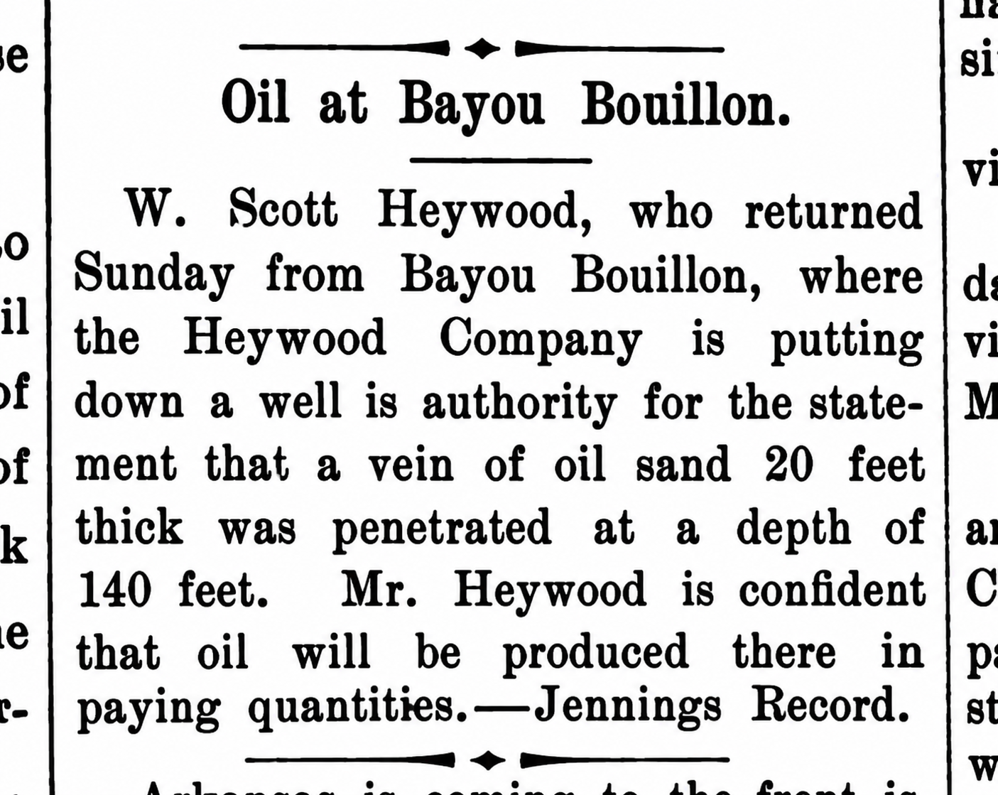
Abbeville Meridional—Saturday, August 9, 1902
Woodland Retreat
The lake’s relative remoteness played no small part in its growing reputation as the quintessential swamp destination. It was remote enough to remain charmingly quaint, even into the middle of the twentieth century, and remote enough that getting there required a little effort—part of the adventure, and part of the appeal. Its extraordinary abundance of fish and blue crabs certainly did nothing to hurt its reputation.
It’s easy to think of the swamp as a dangerous and foreboding place, but Catahoulou’s apartness from society, away from the dense crowds of the city, especially in the age of deadly yellow fever, to which the final sentences of this article allude, would have been seen as a great selling point. Catahoulou was a secluded place in the woods where people could withdraw from ordinary life—a literal retreat.
Over time, the picturesque and famously fish-filled lake grew into a destination in its own right, reaching its zenith in the first half of the twentieth century, when the lake was arguably the picnic capital of Louisiana—at least going by the astonishing frequency with which picnics on Catahoula Lake turn up in the pages of local and statewide newspapers.
But the lake’s reputation as a getaway was already taking shape in the nineteenth century. This remarkable article from 1882 shows Catahoulou coming to be regarded not simply as a good place to fish, but as a place worth making a journey to see. My translation follows each passage of the original French. The article might even be considered Catahoulou’s first real description in print—its first piece of nature writing, at least.
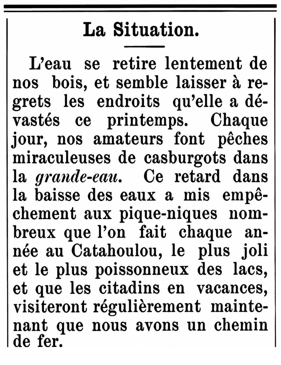
Le Courrier des Opelousas—July 22, 1882
The Situation
The water is slowly retreating from our woods, and seems reluctant to leave behind the places it devastated this spring. Every day, our sport fishermen are making miraculous catches of gaspergou in the high water. This delay in the receding of the water has put the brakes on the picnics we usually see here each year at Catahoulou, the prettiest and most fish-filled of lakes, which vacationing city dwellers on vacation visit regularly now that we have a railroad.
Le Courrier des Opelousas—July 22, 1882
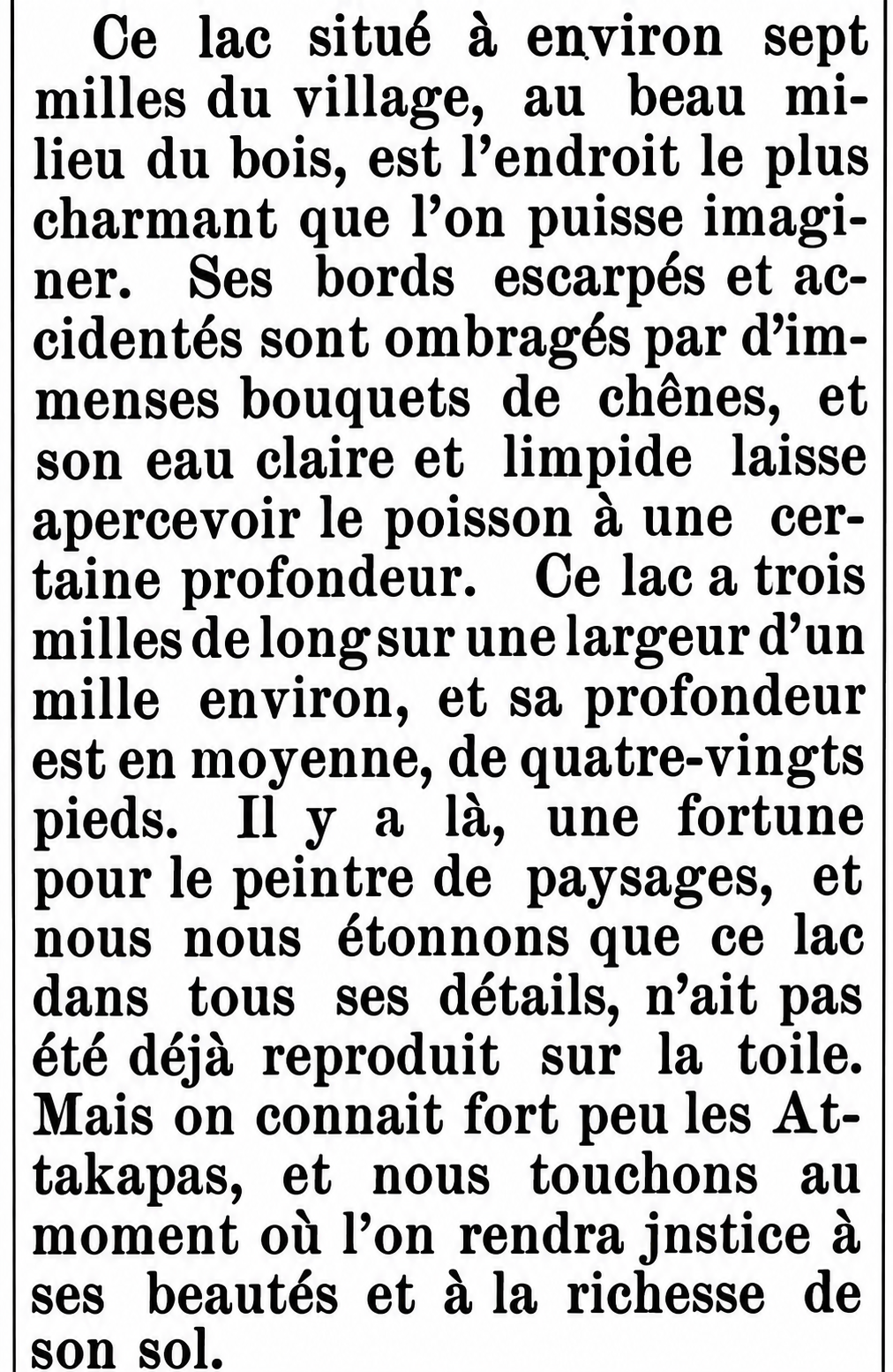
This lake, located about seven miles from the village in the very heart of the woods, is as charming a place as one could imagine. Its steep and rugged banks are shaded by immense groves of oaks, and its crystal clear water allows fish to be seen swimming at considerable depths. The lake is three miles long and about a mile wide, and its average depth is eighty feet. There is a fortune there for the landscape painter, and we are surprised that this lake, in all its details, has not already been reproduced on canvas. We know very little about Attakapas country, but we are approaching the moment when justice will be done to its beauties and the richness of its soil.
Le Courrier des Opelousas—July 22, 1882
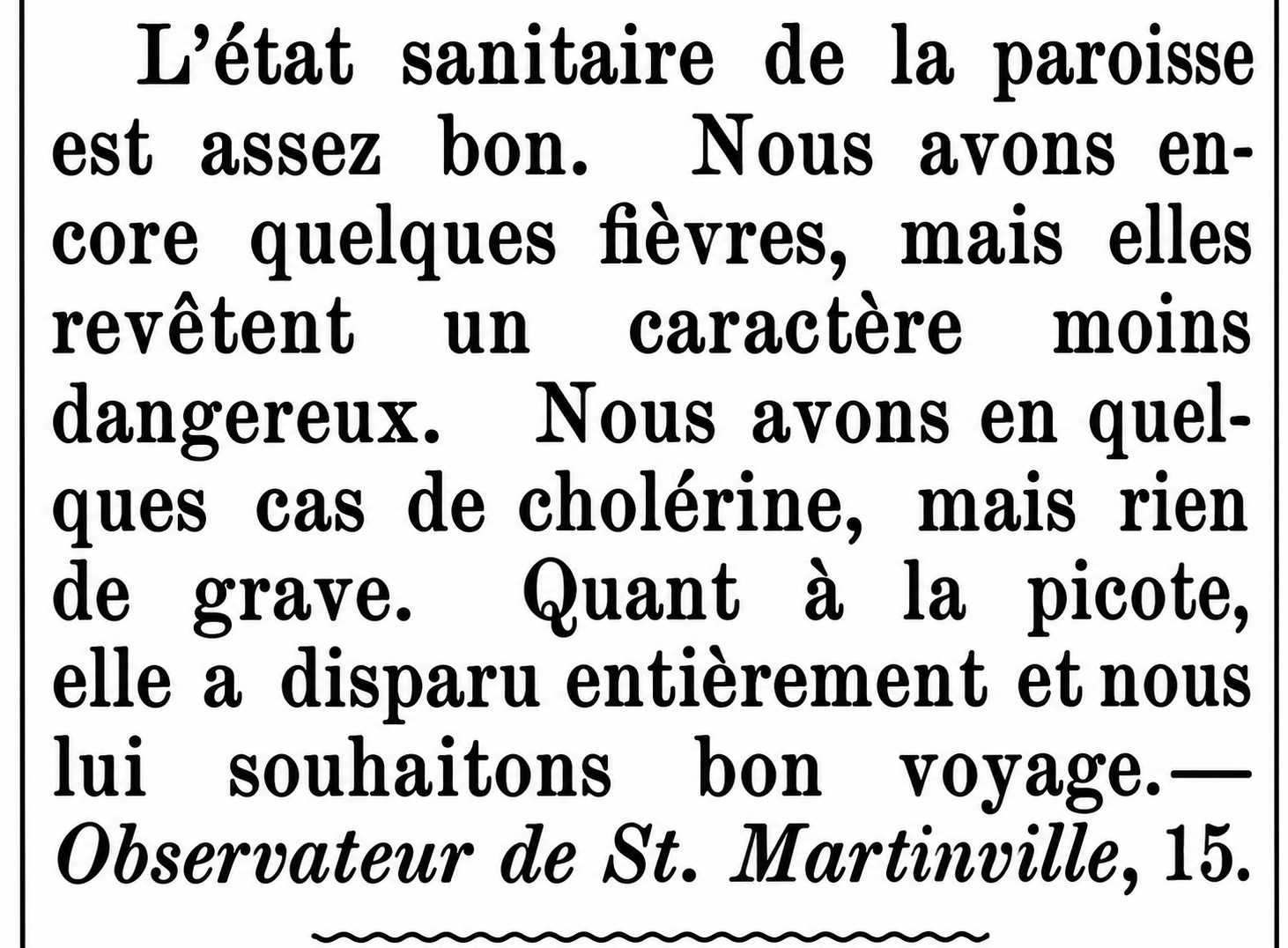
The health of the parish is quite good. Fevers continue to occur here, but they are of a less dangerous character. We have had a few cases of cholera, but nothing serious. As for smallpox, it has disappeared entirely, and we bid it a fond farewell.
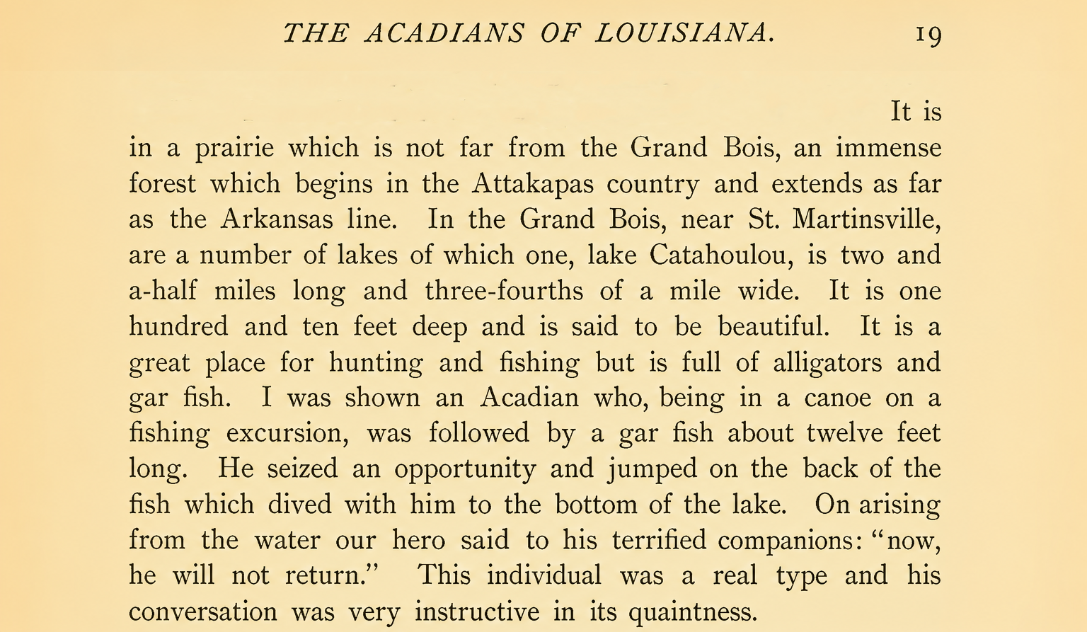
Alcée Fortier offered one of the more colorful nineteenth-century descriptions of Catahoulou in The Acadians of Louisiana and Their Dialect.
Alcée Fortier, The Acadians of Louisiana and Their Dialect—1891
Whether Fortier, or anyone else, actually believed the story hardly matters. Its inclusion tells us something about Catahoulou’s nineteenth-century reputation: a beautiful but still decidedly wild lake in the Grand Bois, known not only for its fish and its alligators, but for the stories told by the people who ventured onto its waters.
Botanical Specimen
What may be the last occurrence of the word Catahoulou in print before it transitioned into the modern spelling appeared in a Belgian botanical journal in 1896.
The Reverend Auguste Barthélemy Langlois (1832–1900), a French-born Catholic priest and an accomplished field botanist was the pastor of St. Martin de Tours in St. Martinville from 1887 until his death in 1900. During those St. Martinville years he was collecting plants intensively throughout the surrounding countryside, ultimately assembling more than 20,000 Louisiana specimens.
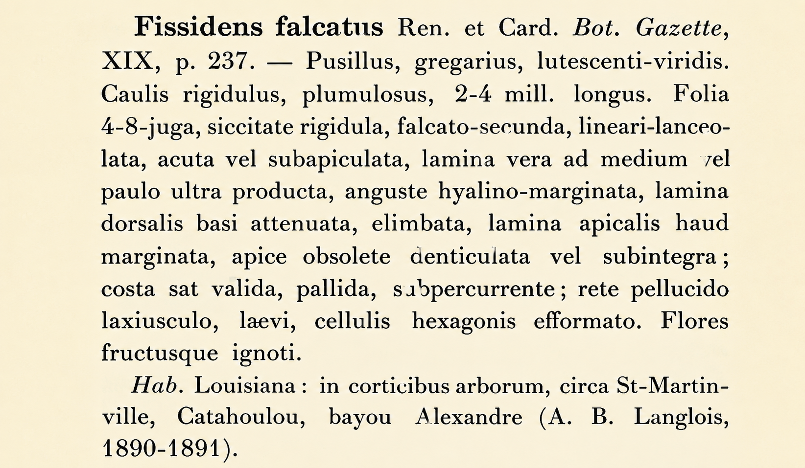
In the Royal Botanical Society of Belgium’s annual proceedings for 1896—New Mosses of North America—he is credited with locating a species of tiny moss, Fissidens falcatus, on the bark of trees, around St. Martinville, Catahoulou and Bayou Alexandre.
Bulletin de la Société Royale de Botanique de Belgique—1896
Notable Absence
A review of nineteenth-century newspapers turned up no mention of the legend of the birth of Catahoula Lake. According to the story as it would later be told, the earth one day split open beneath an Indian village, swallowing the settlement whole and leaving behind a great crystalline chasm, filled with clear water and an almost dreamlike abundance of fish.
Curiously, the legend is absent from 19th century sources and seems to emerge only later. By the middle of the twentieth century, however, it had become one of the animating myths of the growing Catahoula community, reaching something of a heyday in the 1970s, when the story was reenacted annually as an Indian pageant, and the lake itself was celebrated as not a “sacred lake” but a “lake of sacrifice.”
Where the story came from is harder to say. Was it a genuine oral tradition, handed down from the indigenous people who knew the lake long before Europeans arrived? Was it the work of local raconteurs and journalists, sensing something ancient in that beautiful, secluded lake and supplying the missing legend themselves, eager to give such an unusual place an origin story worthy of it? Was the colorful legend embroidered onto the genuinely strange seismic phenomena that took place in 19th century Catahoulou, which would have certainly lived on in the local folklore.
Future Directions
One particularly promising direction for future research is the GuteKunst Collection, an archive of survey maps and plats now being preserved and cataloged by the St. Martin Parish Library. The collection represents more than seventy years of work by Charles and Octave GuteKunst, father and son parish surveyors and land agents whose maps document St. Martin Parish and other parts of southwestern Louisiana from the 1870s through the 1930s.
Together, their work spans a period when the landscape around Catahoulou was undergoing enormous change, and when much of what we now think of as land was still understood and navigated principally in relation to water. That makes the GuteKunst Collection invaluable to reconstructing nineteenth-century Catahoulou.
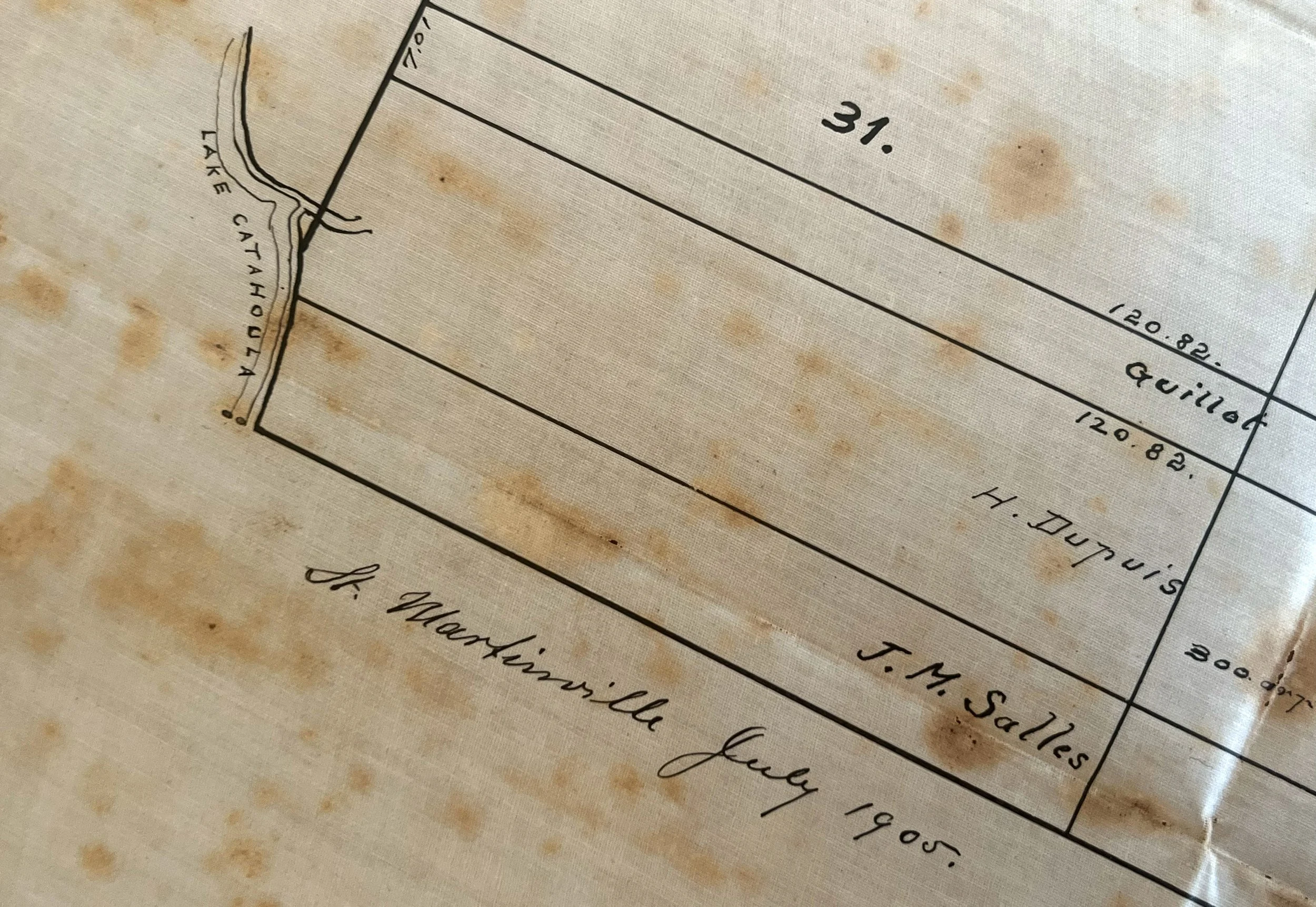
GuteKunst Collection—St. Martin Parish Library
The defining features of this landscape were its waterways: lakes, bayous, coulees, sloughs, backswamps, islands, ridges, and seasonally flooded woods. Modern maps preserve only a fraction of that watery geography. The GuteKunst surveys may help recover some of its lost contours—showing not only where property lines ran, but how people understood, reached, crossed, and inhabited a landscape whose boundaries were drawn as much by water as by land.
Property records offer another promising avenue of research. Nineteenth-century deeds, acts of sale, successions, and land surveys could help identify who owned property around Catahoulou Lake, what was built there, and how the land changed hands over time. Tracing those transactions may make it possible to watch the footprint of the future community of Catahoula gradually emerge.